
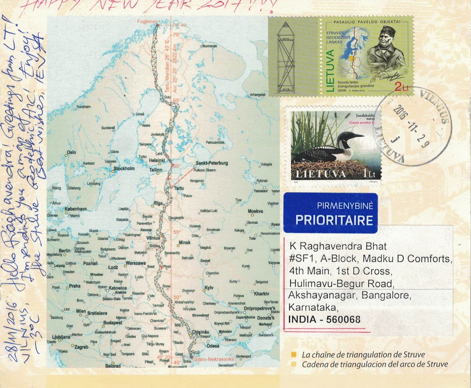
It is a chain of survey triangulations stretching from Hammerfest in Norway to the Black Sea, through 10 countries and over 2,820 km. These are points of a survey, carried out between 1816 and 1855 by the astronomer Friedrich Georg Wilhelm Struve, which represented the first accurate measuring of a long segment of a meridian. This helped to establish the exact size and shape of the planet and marked an important step in the development of earth sciences and topographic mapping. It is an extraordinary example of scientific collaboration among scientists from different countries, and of collaboration between monarchs for a scientific cause.
Struve Geodetic Arc Chain.
1 Norway 2 Sweden 3 Finland 4 Russia 5 Estonia 6 Latvia 7 Lithuania 8 Belarus 9 Moldova 10 Ukraine
Date of Inscription: 2005
Ref: 1187
Extremely thankful to Eva in Lithuania for the rare card with matching stamp.


One more card received today with matching stamp.Than you Eva for the card made by you and affixing matching stamp of 2009 and definitive stamp of year 2000.
No comments:
Post a Comment